The Waterways…

These are my posts documenting the many paddles on our beautiful Florida waterways. I try to provide enough information, along with photos and resources, to help make planning your next trip a little easier and more exciting. I hope you find Florida Paddle Notes interesting and useful. Enjoy and please feel free to comment…See you on the water! – James
Below is a list of waterways we have paddled, followed by an interactive map to those locations with a link to the detailed information.
RIVERS ~ CREEKS & SPRING RUNS ~ LAKES ~ PRAIRIES & WETLANDS ~ CANALS ~ FLORIDA GULF & OTHER OPEN WATERS
Rivers
Alafia River ~ Chassahowitzka River ~ Crystal River – Kings Bay ~ Homosassa River ~ Hontoon Dead River ~ Ichetucknee River ~ Little Manatee River ~ Ocklawaha River ~ Outlet River ~ Rainbow River ~ Santa Fe River ~ Silver River ~ St. Mary’s River ~ Suwannee River ~ Tomoka River ~ Waccasassa River ~ Weeki Wachee River ~ Wekiva River ~ Wekiva River (Lower) ~ Withlacoochee River (N) ~ Withlacoochee River (S)
Creeks and Spring Runs
Alexander Spring Creek ~ Alligator Creek ~ Bear Creek ~ Black Creek – North Fork ~ Bulow Creek North ~ Cannon Springs ~ Crawford Creek ~ Cross Creek ~ Deep Creek ~ Dunns Creek ~ Durbin Creek ~ Gilchrist Blue Spring Run ~ Gissy Spring ~ Gum Slough ~ Haw Creek ~ Juniper Creek Upper ~ Juniper Creek Lower ~ Manatee Springs ~ Mud Spring ~ Olustee Creek ~ Otter Creek ~ Pellicer/Styles Creek ~ Prairie Creek ~ Rock Springs Run ~ Salt Springs Run ~ Sweetwater Creek
Lakes
Floral City Lake – Tsala Apopka ~ Halfmoon Lake ~ Lake Disston ~ Santa Fe Lake ~ Black Lake
Swamps, Prairies, and Wetlands
Okefenokee Swamp ~ Paynes Prairie ~ Smokehouse Prairie
Canals
Buckman Lock ~ Dora Canal ~ Santa Fe Canal
Florida Gulf and Other Open Waters
Cedar Keys – Atsena Otie Key ~ Cedar Keys – Scale Key ~ Cockroach Bay ~ Cumberland Island South ~ Fort De Soto – Mullet Key Bayou
Interactive Florida Paddle Trails Map
Each location marker has a link to the detailed post for that waterway…
Open a larger map in your browser…
THE WATERWAYS ~ FPN RESOURCES ~ ABOUT FPN ~ CONTACT FPN
Most recent paddles are listed below…

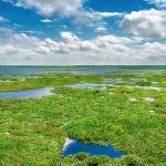 Paynes Prairie is a large 32 square mile wetland basin located between Gainesville and Micanopy, Fl. The Prairie primarily drains into Alachua Sink in the Northeast portion of the basin. In 1871 this sink became blocked and for almost 20 years Paynes Prairie was known as Alachua Lake…James
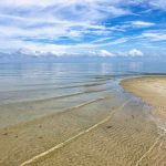 In 1868 the Eberhard Faber Pencil Company built a lumber mill on Atsena Otie, supplying cedarwood to its pencil factory in New Jersey. A major hurricane and 10’ storm surge destroyed the mill in1896. Much of the salvaged homes as well as wreckage from the mill were floated over to re-establish the town of Cedar Key on Way Key……James
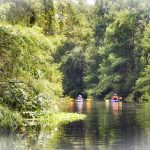 Prairie Creek is part of the Potano Paddling Trail, which includes circumnavigating Newnan’s Lake. This is a Florida State Designated Trail. Prairie Creek drains Newnan’s Lake, flowing into Paynes Prairie State Preserve and Orange Lake…James
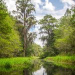 The Santa Fe Canal in Alachua County, connects Lake Alto, East of Waldo with Little Lake Santa Fe, north of Earlton. Both lakes comprise the headwaters for the Santa Fe River. Due to a lack of decent roads after the Civil War, the canal was dug to connect Waldo with Melrose…James
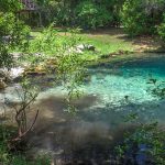 Mud Spring is a 4th magnitude spring, surrounded by the palms and palmettos of the Welaka State Forest. The boil is in the center of an oval-shaped pool roughly 85′ x 65′. An average depth of the spring is about 4′ deep. It is the head of Mud Creek which flows southeast for just under a half-mile into Mud Creek Cove, part of Little Lake George which is part of the St Johns River….James
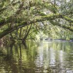 A 26 mile Designated Paddling Trail runs from High Springs to Branford at the Suwannee River. The upper portion of this stretch has an abundance of popular springs and after the Ichetucknee River flows into the Santa Fe the river widens. In this section, there is more development and there are numerous powerboats as it flows into the Suwannee River…James
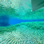 The Rainbow River is located, in Dunnellon, Fl, about 20 miles southwest of Ocala, in Marion County. The headspring, Rainbow Spring, is a 1st magnitude spring that ranks 4th in the state for volume, discharging 400-600 million gallons of water a day! The spring is composed of numerous vents rather than one single vent…James