The Waterways…
These are my posts documenting the many paddles on our beautiful Florida waterways. I try to provide enough information, along with photos and resources, to help make planning your next trip a little easier and more exciting. I hope you find Florida Paddle Notes interesting and useful. Enjoy and please feel free to comment…See you on the water! – James
Below is a list of waterways we have paddled, followed by an interactive map to those locations with a link to the detailed information.
RIVERS ~ CREEKS & SPRING RUNS ~ LAKES ~ PRAIRIES & WETLANDS ~ CANALS ~ FLORIDA GULF & OTHER OPEN WATERS
Rivers
Alafia River ~ Chassahowitzka River ~ Crystal River – Kings Bay ~ Homosassa River ~ Hontoon Dead River ~ Ichetucknee River ~ Little Manatee River ~ Ocklawaha River ~ Outlet River ~ Rainbow River ~ Santa Fe River ~ Silver River ~ St. Mary’s River ~ Suwannee River ~ Tomoka River ~ Waccasassa River ~ Weeki Wachee River ~ Wekiva River ~ Wekiva River (Lower) ~ Withlacoochee River (N) ~ Withlacoochee River (S)
Creeks and Spring Runs
Alexander Spring Creek ~ Alligator Creek ~ Bear Creek ~ Black Creek – North Fork ~ Bulow Creek North ~ Cannon Springs ~ Crawford Creek ~ Cross Creek ~ Deep Creek ~ Dunns Creek ~ Durbin Creek ~ Gilchrist Blue Spring Run ~ Gissy Spring ~ Gum Slough ~ Haw Creek ~ Juniper Creek Upper ~ Juniper Creek Lower ~ Manatee Springs ~ Mud Spring ~ Olustee Creek ~ Otter Creek ~ Pellicer/Styles Creek ~ Prairie Creek ~ Rock Springs Run ~ Salt Springs Run ~ Sweetwater Creek
Lakes
Floral City Lake – Tsala Apopka ~ Halfmoon Lake ~ Lake Disston ~ Santa Fe Lake ~ Black Lake
Swamps, Prairies, and Wetlands
Okefenokee Swamp ~ Paynes Prairie ~ Smokehouse Prairie
Canals
Buckman Lock ~ Dora Canal ~ Santa Fe Canal
Florida Gulf and Other Open Waters
Cedar Keys – Atsena Otie Key ~ Cedar Keys – Scale Key ~ Cockroach Bay ~ Cumberland Island South ~ Fort De Soto – Mullet Key Bayou
Interactive Florida Paddle Trails Map
Each location marker has a link to the detailed post for that waterway…
Open a larger map in your browser…
THE WATERWAYS ~ FPN RESOURCES ~ ABOUT FPN ~ CONTACT FPN
Most recent paddles are listed below…

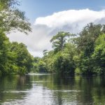 The Santa Fe River is a 75-mile river in north-central Florida and derives its name from a Franciscan mission named Santa Fé de Toloca once located near the river. Its source is Lake Santa Fe – Little Lake Santa Fe located north of Melrose and East of Waldo. The upper half of The Santa Fe is a small, winding creek that often dries in low water periods and the river is usually a slow-flowing river…James
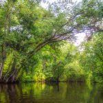 The 74 mile Ocklawaha River is a must paddle for those interested in ‘Old Florida’. It’s history is rich as are the wildlife and surrounding forests. One of the most popular and uninhabited sections of the river is from Gores Landing to CR 316, see map below…James
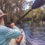 The weather forecast changed over the course of the early morning. By the time we arrived at the launch in Silver Springs State Park the forecast was upwards of a 60-70% chance of rain. As the last of the kayaks entered the water, the sky was dark and thunder heralded our launch. We agreed to proceed, cautious about lightning, and assumed we would get wet…James
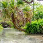 Juniper Creek – Upper is a 7-mile winding waterway originating from Juniper Springs in the Ocala National Forest, Marion County. The creek flows through several sections of beautiful, diverse forest and wilderness eventually flowing into the St. Johns River…James
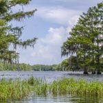 Tsala Apopka Lake is a chain of lakes located within a bend in the Withlacoochee River with a surface area of over 19,000 acres. Tsala Apopka Lake is located in Citrus County in north central Florida. The area contains numerous lakes, heavily vegetated marshes and swamps that encompass several islands and is often referred to as The Cove of the Withlacoochee…James
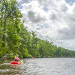 Dunns Creek is rather wide for a creek, ranging from 275′ – 500′. The easterly side of the creek is populated for almost the last 1/2 of the distance, while the westerly side includes sandhills and wetlands. Among several protected species are the Gopher Tortoise –
 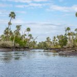 The Waccasassa River is a small, isolated river East of Gulf Hammock on HWY 326, Levy County. The entire river is 29 miles long, however, only a few miles are navigable. The Waccasassa is one of the most undeveloped rivers in Florida. Originating west of Bronson from diffuse swamp waters of southern Waccasassa Flats, and beginning a defined channel after receiving flow from Blue Spring…James
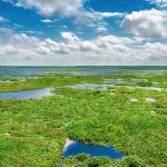 Paynes Prairie is a large 32 square mile wetland basin located between Gainesville and Micanopy, Fl. The Prairie primarily drains into Alachua Sink in the Northeast portion of the basin. In 1871 this sink became blocked and for almost 20 years Paynes Prairie was known as Alachua Lake…James
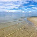 In 1868 the Eberhard Faber Pencil Company built a lumber mill on Atsena Otie, supplying cedarwood to its pencil factory in New Jersey. A major hurricane and 10’ storm surge destroyed the mill in1896. Much of the salvaged homes as well as wreckage from the mill were floated over to re-establish the town of Cedar Key on Way Key……James