Chassahowitzka River Overview

The Chassahowitzka River (pronounced “Chaz-wits’-kuh”) is a spring-fed river located in southwestern Citrus County, Fl. south of Homosassa Springs. The river is 5.6 miles long from source to the gulf, flowing through the Chassahowitzka National Wildlife Refuge. Chassahowitzka was named after a wild variety of vining, hanging pumpkin that grew along the shoreline and translates as “hanging pumpkin”.
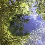
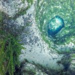
Chassahowitzka Spring, a 1st magnitude spring is the headwater of the river. Just East of the main vent is a group of smaller springs, some connected by caves, known as the Seven Sisters, Chassahowitzka Solution Holes, or Chassahowitzka #1, #2. There are a number of tributaries feeding into the river heading downstream. Fed by springs from these tributaries, the water eventually becomes a mix of fresh water and salt water known as brackish water.
The spring-fed Chassahowitzka River was named an Outstanding Florida Waterway for its pristine, natural condition and receives protection to maintain the water quality. The main river is wide, shallow and slow moving. It is an easy paddle, though some of the spring runs may present challenges due to downed trees and shallow water.
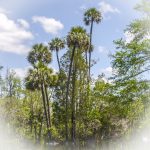
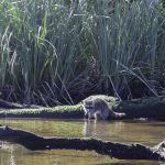
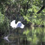
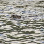
The Chaz has an abundance of wildlife to include Otters, Ferel Pigs, Raccoons, Egrets, Herons, Eagles and Ospreys among others. Fishing is excellent. The shoreline forests are a beautiful jungle-like mix of Palms, Cedars, Red Maples, Hickories and Bay. See the Flora and Fauna galleries below…
Chassahowitzka River Details
![]() Location: Southwestern Citrus County, Fl, 6 miles south of Homosassa Springs, HWY 98 then 1.75 mi West on Miss Maggie Drive
Location: Southwestern Citrus County, Fl, 6 miles south of Homosassa Springs, HWY 98 then 1.75 mi West on Miss Maggie Drive
![]() Launch point: Chassahowitzka River Campground – 8600 W Miss Maggie Drive Chassahowitzka, Fl 34448 Phone 1-352-382-220. There is a nominal parking fee.
Launch point: Chassahowitzka River Campground – 8600 W Miss Maggie Drive Chassahowitzka, Fl 34448 Phone 1-352-382-220. There is a nominal parking fee.
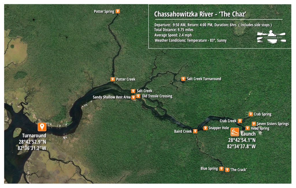
![]() Paddle Distance: This paddle is 9.7 miles which includes side paddles up Potter Creek, Salt Creek, Crab Creek, Baird Creek and the Seven Sisters. This paddle was 2.4 miles out on the Chaz turning around before getting to Johnson Creek.
Paddle Distance: This paddle is 9.7 miles which includes side paddles up Potter Creek, Salt Creek, Crab Creek, Baird Creek and the Seven Sisters. This paddle was 2.4 miles out on the Chaz turning around before getting to Johnson Creek.
![]() Difficulty: Easy to moderate. The river is open with a nice easy flow. I say moderate because there are some obstructions and portages on the final stages of Baird Creek just before entering ‘The Crack’
Difficulty: Easy to moderate. The river is open with a nice easy flow. I say moderate because there are some obstructions and portages on the final stages of Baird Creek just before entering ‘The Crack’
 Average Paddle Time: Paddle speed was about 2.4 mph. A straight paddle from launch to turnaround on this trip is 2.5 miles and can be done in a couple of hours up and back. Side paddles make this an interesting trip and can add an additional 5 miles going up and back the several creeks.
![]() Width and Depth: The river varies in width, starting around 115′ wide and at the turn around point 400′ wide. Potter Creek begins around 115′ wide and finishes around 65′ wide, with Salt Creek being very similar. Baird Creek varies from 20′ to 40′ most of the way with larger pools along the way to the crack. The entire river is very shallow and in the channel can range from 1′ – 4′ deep.
Width and Depth: The river varies in width, starting around 115′ wide and at the turn around point 400′ wide. Potter Creek begins around 115′ wide and finishes around 65′ wide, with Salt Creek being very similar. Baird Creek varies from 20′ to 40′ most of the way with larger pools along the way to the crack. The entire river is very shallow and in the channel can range from 1′ – 4′ deep.
![]() Current – Tidal: The Chassahowitzka is influenced by not only tides, but also the springs that feed into it. The flow is slow.
Current – Tidal: The Chassahowitzka is influenced by not only tides, but also the springs that feed into it. The flow is slow.
![]() Side Paddles: There are several side paddles on this section of the river. Aside from the Seven Sisters, there is Crab Creek, Baird Creek, Salt Creek and Potter Creek to venture up. Baird Creek leading to a wonderful spring known as ‘The Crack’ is a must side paddle on this trip.
Side Paddles: There are several side paddles on this section of the river. Aside from the Seven Sisters, there is Crab Creek, Baird Creek, Salt Creek and Potter Creek to venture up. Baird Creek leading to a wonderful spring known as ‘The Crack’ is a must side paddle on this trip.
![]() Rest Areas: There are a few areas to stop along the way to rest, ie The Crack, areas along the banks. There is a shallow area, on the south bank of the Chaz across from Potter Creek and near the remnants of the trestle.
Rest Areas: There are a few areas to stop along the way to rest, ie The Crack, areas along the banks. There is a shallow area, on the south bank of the Chaz across from Potter Creek and near the remnants of the trestle.
Chassahowitzka River Paddle Map
The Launch
I love to paddle the Chaz. There is a genuine wildness to it as well as a beauty that make for a pleasant paddle. The launch at Chassahowitzka Campground is very good. There is a boat ramp as well as a soft launch from a sandy beach. The folks are very friendly. I usually get there early to secure a parking spot.
From the beach launch it is only about 350′ upstream to find the Chassahowitzka Main Spring. The spring is surrounded by swamp forest and a mixture of hardwoods with plenty of Bald Cypress and Sabal Palmettos. Several hundred feet further upstream are other vents known as Chassahowitzka #1 and #2 or the Chassahowitzka Solution Holes. I try to get here early at this spot in order to get photographs before the crowds arrive. I do however, return at the end of my paddle spending time cooling off in the crystal clear water.
The Chaz
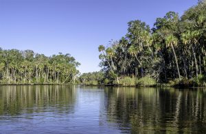
The Chaz is one of those rivers that I truly feel like an adventurer paddling on it. I think it is the wildness look to it, the different scenarios on each side creek and then the openness as it nears the Gulf. It presents adventure in many ways. This particular paddle is also nice because the paddle distances are short to each area of exploration keeping things fresh and exciting.
This stretch of the river is a popular paddling trip due to the side paddles and springs. On this paddle I visited the springs listed below… For a more in depth look at location and descriptions, open the interactive springs map or look over several of the Maps and Guides listed above…
Chassahowitzka Main Spring
This spring is the headwaters of the Chassahowitzka River and lies in the river run. It is only 350′ from the beach launch at Chassahowitzka Campground. The boil depth varies depending on the water level averaging 18′ deep and is only visible at low tide. Because the spring vent is hard to see and diving is prohibited, this isn’t a major ‘must see’ on the river. The spring is surrounded by hardwood swamp, cypress and palms.
Chassahowitzka #1 & #2, Chassahowitzka Solution Holes
240′ upstream from the main spring are several vents known as Chassahowitzka Spring No. 1 and Chassahowitzka Spring No. 2 . I have read that they are also referred to as the ‘Solution Holes’ and the ‘Sisters’ This is a great place to relax, cool off and explore the vents. There is a series of five vents, at least three of them are connected and can be explored underwater. The water is very clear and the vents are beautiful. I usually visit these springs both at the beginning of my paddle and at the end.
Crab Creek
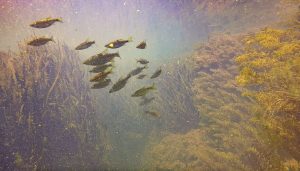
1/10 of a mile, downstream from the launch, is the entrance to Crab Creek. The creek is about 75′ wide at the entrance and fluctuates between 40 and 50 feet throughout the length of the run. This creek is full of dense beds of filamentous algae – Chaetomorphaand Enteromorpha, eelgrass – Vallisneria americana and others.
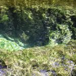
The creek leads to Crab Creek Spring a tenth of a mile up the run. The spring is located next to a private residence so remaining on the water is a must, though entering the water and exploring the spring is fine. The underwater vegetation is covered with rust colored diatom algae and the water is milky with floating chalky deposits.
Baird Creek aka ‘The Crack’
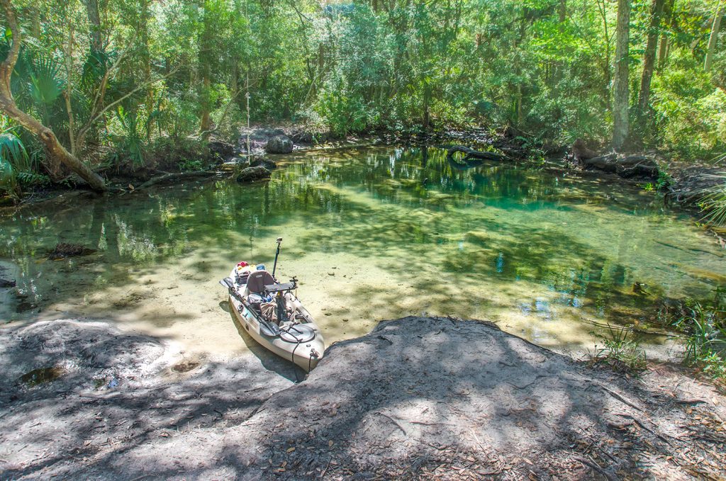
One of the biggest reasons I get here early, as well as come during the week, is to reach ‘The Crack’ before it is crowded. Just over a half a mile from the launch passing Snapper Hole on the left is the entrance to Baird Creek. A tiny island, with palm trees help mark the entrance. This is an excellent creek to paddle! The creek is 50′ wide and the start and is scarcely 20′ wide at the destination. This is a beautiful paddle through saw grass lined channels, larger pools at Blue Spring and then a tropical, canopied crystal clear creak running from Baird Creek, more commonly known as The Crack.
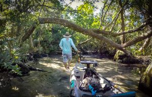
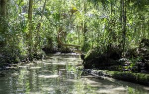
On the several times I have paddle to the Crack I have never been able to paddle the entire length into the spring. There are numerous tree obstacles to maneuver and the water is very shallow in some points. I have however, always been able to portage the kayak all the way into the crack and on several occasions. I’ve been luck to enjoy this beauty for over an hour with no other folks around. Baird Spring, aka The Crack, is one spring I continue to savor and enjoy. It is a hidden gem in a tropical and hardwood swamp forest and by the time I have portaged through the obstacles, I feel I am a true adventurer!
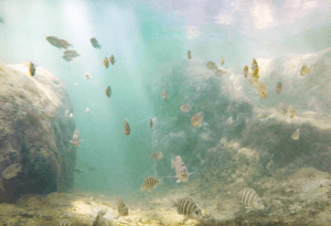
I have to mention, that on the way to and from the crack there is a very small side paddle to a circular pool adjacent to blue springs pool on the west side – 28°42’33.72″N, 82°34’48.66″W.
Blue Spring on Baird Creek
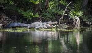
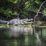
I have often heard about a very large alligator residing here so on my way back up from The Crack I paddled into the pool to check it out. On the west bank, on a log was the gator!
I paddled closer fro a better look and for a photo and this gator was huge, well over 12′ the size of my kayak. The moment I composed my photo, the gator loudly grunted, opened his mouth and hissed and proceeded to enter the water! I may never have paddled any faster than I did that morning, but I left that little pool of water at high speed and yes I got the shot!
Leaving Baird Creak the river begins to widen and at 0.9 mile from launch, are the two islands, 28°43’0.79″N, 82°35’20.86″W. Keeping to the right avoids any power boats that use the main channel on the left. Once past the islands are the remnants of the old trestle, a bit hard to see but a good eye will pick it out. On two occasions in this area I have had the pleasure to watch several otters playing and swimming along side the kayak.
Salt Creek
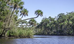
This area also marks the entrance to Salt Creek, which at first does not seem too exciting. There are several dead and downed trees and a lot of algae growth at the beginning but Salt Creek offers some of the best ‘Jungle-like’ views on the river. Paddling up Salt Creek can be tricky and I find it best to keep right and eventually paddle into a wide lagoon. There are several side channels so it is important to keep track of your location when returning to the river.
Potter Creek
Potter Creek was the last creek for this particular trip. It is an easy paddle up stream, the creeks opens around 100′ wide and thins to almost half that by the time Potter Springs is reached. If it is clear of obstructions, and if the water level is good, Ruth Spring is accessible from a small entrance at the north end of Potter Spring. I have yet to be able to paddle to Ruth Spring.
The River is Wide
Exiting Potter Creek and entering the Chassahowitzka River is interesting. Here the river is 600′ wide, somewhat intimidating after paddling the narrow creeks. I paddled close to the northwesterly shoreline to avoid several motorboats that cruised by.
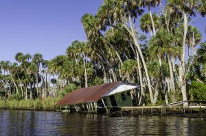
On both sides of the river, scattered, abandoned homes lie deteriorated and destroyed from previous storms. I decided to make my turn around at 28°42’52.58″N, 82°36’31.81″W, just before the river opened even wider on it’s way to the Gulf. On return I stayed close to the Southeasterly shore which was also lined with homes but these seemed still inhabited.
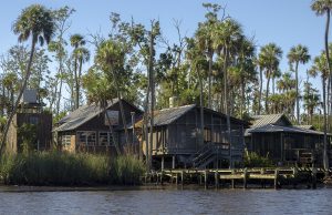
Along this shoreline there was more sandy beach area to get out on and rest a bit and some beautiful areas of vegetation and water grasses. From here it was back to the beginning to rest and refresh in the clear waters of the sisters springs Chassahowitzka #1 and #2. It was a long day and a great day for exploration on The Chaz!
Flora Gallery
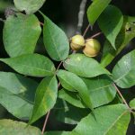
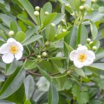
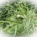
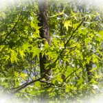
Trees: The shoreline forests are a beautiful jungle-like mix of – Bald Cypress -Taxodium distichum, Cabbage Palm – Sabal Palmetto, Loblolly Bay – Gordonia lasianthus, American Sweetgum – Liquidambar styraciflua, Red Maple – Acer rubrum, Red Cedar – Juniperus virginiana, Pignut Hickory – Carya glabra and others.
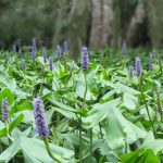
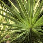
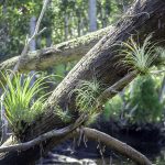
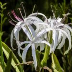
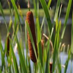
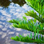
Shrubs, Grasses, Aquatic and Flowering Plants: The river has abundant underbrush and aquatic plants that include – Bartram’s Airplant – Tillandsia bartramii , Pickerelweed – Pontedaria cordata , American Eelgrass – Vallisneria americana, Cattail – Typha latifolia, Sawgrass – Cladium jamaicense, Swamp Lily – Crinum pedunculatum, Giant Leather Fern – Acrostichum danaeifolium, Salt Marsh Cordgrass – Spartina spp, Saw Palmetto – Serenoa Repens, Black Needle Rush – Juncus roemerianus
Trees, Shrubs, Grasses, Aquatic and Flowering Plants – Gallery
Fauna Gallery
While the Chassahowitzka River and Refuge are host to numerous species of wildlife I only got pics of a few on this paddle…
Guides, Maps & Info…
- Chassahowitzka Wilderness at Wilderness Connect…
- US Fish and Wildlife Service – Chassahowitzka National Wildlife Refuge…
- Chassahowitzka River Campground…
- Florida Nature Coast – Chassahowitzka National Wildlife Refuge…
- Springs Fever also has excellent information on some of the springs along the Chaz…
- A great interactive map for Florida Springs. This opens in Google Earth for me…
- Florida Geological Survey Bulletin #66 – Springs of Florida (pdf)…
- Florida Springs Database
![]()


